We can now truly claim that we have visited all four corners of our beautiful province!
Our northern B.C. section started in Dawson Creek, which is Mile 0 for the Alaska Highway. We even went over the only original trestle bridge that is left of the old highway, just outside Dawson Creek.
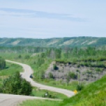
It didn’t take us long to make another detour…having arrived at Fort St. John very early in the morning (nothing open except Overwaitea), we carried on and veered off to Hudson’s Hope and the W.A.C. Bennett dam. The dam is 110km off the Alaska highway but we got to observe the last of the Peace River valley before they flood it for Site C 😦
As we did the tour at the W.A.C. Bennett dam, and enjoyed their visitor centre, it was interesting to hear and read about the history of the current dam, as well as the careful tip-toeing around the issue of First Nations land rights…in the past and the present. Fool me once…! And the cute little hamlet of Hudson’s Hope, an historic Hudson’s Bay outpost, would be cut off from the road to Fort St. John.
Back to the Alaska Highway found us driving over the high prairie to Fort Nelson, where there is really nowhere to pull over as all the side roads are private access roads to the oil & gas and timber companies. We passed several roadside bunkhouse hotels for crew. The lowest point on the Alaska Highway is the Peace River bridge into Fort Nelson.

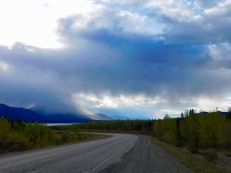
Heading northwest from Fort Nelson meant crossing the Rockies again, with varying scenery and weather systems throughout:
Stuart loves continental divides! On this one, we stopped to do a hike at the summit, but as it was quite cool out, we shortened it, finding instead a wonderful creek with aqua pools of fresh snow melt water. As the path was under snow just a couple of weeks ago, the previous year’s path was faint, and often disappeared. So we had to make our own path…guess we found an adventure!
Then there is the outstanding Muncho Lake. An amazing colour due to the copper, and the surrounding mountains looks like a charcoal sketch.

Muncho Lake
Shortly after, we spend a couple of nights at Liard River Hot Springs, a favourite stop for almost everyone driving the Alaska Highway. The hot springs form a lush, almost tropical micro-climate, covered in ferns and flowers not normally found at this latitude. The provincial campground is the access point and they have added some amenities to protect the fragile landscape. Six streams (up to 54C) feed these pools and they are open all the time.
Next is crossing into the Yukon and arriving at the crossroads that is Watson Lake. This is approximately the half-way point on the Alaska Highway, and apart from an interesting video and information display about the history of the highway, Watson Lake is all about the Signpost Forest…at current count just about 70,000 signs! And signs are brought from all over the world, sometimes custom made, sometimes made with whatever materials are on hand. As we didn’t have the foresight to lift a Penticton city sign, we added our own Penticton placard. One could waste a lot of time walking through this park.
After Watson Lake, the road crosses the B.C./Yukon border 6 times, and by evening, we find ourselves once again detouring off the Alaska Highway to visit Atlin, B.C. A tiny community with 400 residents, a First Nations community, with most of their services obtained in Whitehorse (2 hours away). We had heard that Atlin was beautiful but we were unprepared for the jaw-dropping vistas all along the 100 km road “detour.” After camping in a remote area on the edge of Lake Snafu (with a full moon rising in a sky that never got totally dark), we walked around the townsite and spoke to some of the locals. Many non-indigenous people seem to come for a visit and then decide to stay. It is known for its arts and has a big arts and music festival every July.
We decided to hike Monarch Mountain which is 7km but it was very challenging as it is straight up a mountain, very steep and gravel-filled (scree) trail for the most part (think Grouse Grind x 3). It was much more challenging than the “difficult” hike we did at Jasper. However, the views were breathtaking! Atlin town site if barely visible from even half-way up the mountain.
Other delights in and around Atlin included the warm springs, seeing the Llewellyn glacier from across the lake, and the light playing on Atlin Lake (B.C.’s largest lake – who knew? It looked like a fjord to us…).

Warm springs, south of Atlin


Atlin Lake
During all our hikes, a variety of flowers are emerging that make for a colourful, but short season in these parts.
And last, but not least, we had the opportunity to see wild life all in B.C. Perhaps we don’t need to travel any further ???


